Markers
Overview
Markers are special points marked on the map as flags that could be quickly created as a single tap without specifying name and other information in contrast with Favorite points. Also markers provide additional functionality with widgets, arrows (Show arrows on the map) and distance indication (Distance indication).
- Android
- iOS
Markers
Add / Edit Markers
- Android
- iOS
Short or long tap the map and select the required action from the map context menu.
Short or long tap the map and choose needed action in map context menu.
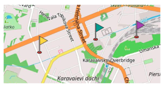
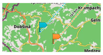
It is possible to mark a point or an object to make it easier to plan navigation. You just need to tap the flag (Android) or arrow (iOS) icon in the menu to display direction and distance to the selected point from your current location (or the centre map point / the initial map touching point when the Location is off).
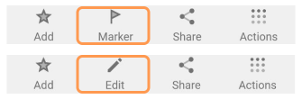
Actions:
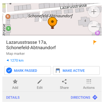
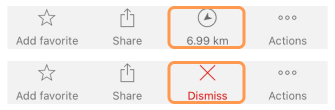
- Marker / Edit map marker. Puts a new marker on the selected point.
- Mark passed (Android) / Dismiss (iOS). Deactivates marker and puts it to the History.
- Make active (Android). Moves marker to the top position (on the top panel).
- Restore marker (Android). Moves marker from History to active list.
You can't delete marker immediately, you need to first deactivate (mark as passed) it, so it's moved to History and then you can permanently delete from history. Once marker deactivated it will be removed from map and itinerary list.
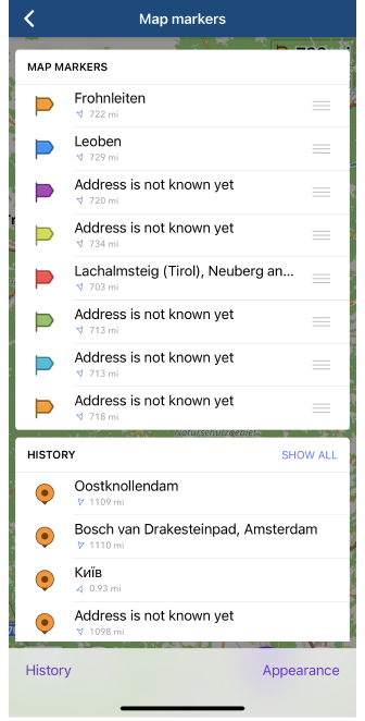
Itinerary List
Itinerary list represents an ordered list of markers where top 1st marker used in widgets for navigation. Read more about it in Navigate by markers article.
Marker Groups
This feature is currently not available for the iOS version of the OsmAnd app.
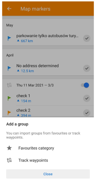
Markers can be added and deleted as a whole group from Favorite group or GPX file with waypoints. That makes it's very convenient to be used in a special navigation mode - Navigate by markers.
History
- Android
- iOS
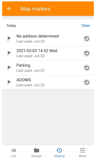
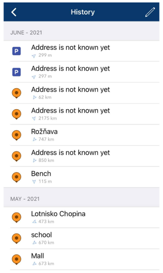
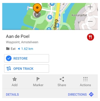
History is a list of all deactivated (passed) markers. From this list it's possibly to permanently delete a marker or restore it back.
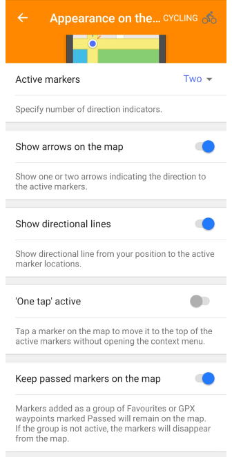
Appearance on the Map
- Android
- iOS
Go to: Menu → Map markers → More → Appearance on the map
Go to: Menu → Map markers → [object Object]
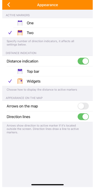
The Appearance on Map menu is a general setting for displaying markers and additional pointers to them. In the iOS version of OsmAnd, Appearance on Map is also a setting for displaying widgets.There are also additional settings for configuring the widgets with markers.
- Active markers. Shows information about the first one or two markers in the Map marker list.
- Distance indication (for iOS). Allows you to choose whether or not to display widgets and how they will appear: above the map (Top bar) or on the right side of the screen (Widgets).
- Arrows on the map. Indicates the direction to the tracked marker (one or two) as an arrow on the map. If the marker is in the visible part of the map, no arrow is displayed.
- Direction line. Shows the direction, as a dashed line, from a particular point on the map to the tracked marker in a straight line.
- One tap active (for Android). With a one-tap the required marker on the map, this marker moves to the top of the list of active Map markers without opening the Context menu.
- Keep passed markers on the map (for Android). Markers added as a group of Favorites or GPX waypoints marked Passed will remain on the map. If the group is not active, the markers will disappear from the map.
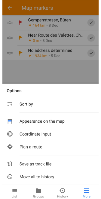
Plan Route for Markers
This feature is currently not available for the iOS version of the OsmAnd app.
Menu → Map markers → More → Plan a route
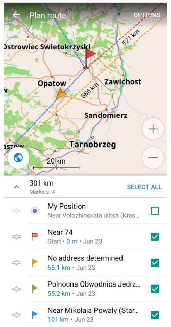
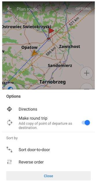
Using functionality of the Plan a route in Markers list tool you can sort Markers Door-to-door, put them in reverse order or create a Round trip. If you tap a Navigation option, Markers will be used as intermediate destinations.
Actions
This feature is currently not available for the iOS version of the OsmAnd app.
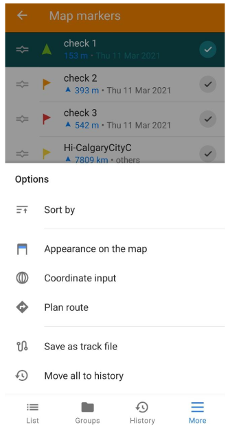
- Sort by. Markers can be sort in list by name, proximity, adding time.
- Appearance on the map or Appearance. Settings for Map markers.
- Coordinate input. Adds Markers by coorditanes input.
- Plan a route. Builds route for navigation using chosen markers.
- Save as track file. Saves active markers in a GPX file.
- Move all to history. Deactivates all markers and move them to History.